/-84.085108,34.143237,12/300x186@2x?access_token=pk.eyJ1IjoibHpjYW11dGkiLCJhIjoiY2o3a281dWJvMHE4ajMzbGF4enJyNHRiciJ9.DhYjvPk5E_wJvys5DU5v2A)
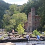
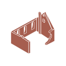
Fish Weir at Bowman’s Island
Just south of Buford Dam, a historic fish weir ripples the surface of the Chattahoochee River in a distinctive “V” shape, channeling fish and water towards the center of the river. It’s thought that the Cherokee that used to live on the land near the River built these fish weirs from stones hundreds of years ago. At the bottom of the V, a wooden basket would be placed to catch the fish flowing through. Such hidden Native American sites will be woven into the planning and design of the Chattahoochee RiverLands Greenway. Knowledge of these practices enriches the River experience for visitors, expands our understanding of the River and the land before it was called Georgia, and finally, reminds us that we are part of a continuum of human cultures that have stewarded the RiverLands.

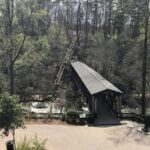
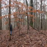
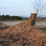
This site visit was part of the 100-mile Windshield Driving Tour – a multi-day driving tour along the banks of the full 100-mile river corridor from December 10-14, 2018. The tour allowed the Design Team to ground truth GIS data with on-the-ground site explorations, photography and video documentation. The Design Team engaged with the community members and interviewed stakeholders on the river as face-to-face research that informs the project and forces an authentic identity for the Chattahoochee RiverLands Greenway. Download the full summary of the tour to learn more.