How the RiverLands started, how it will grow, and everything you need to know to discover how Metro Atlanta and its visitors get outdoors on the banks of the Chattahoochee.
The project has four main goals. To build:
The RiverLands will bypass sensitive habitats and avoid negatively impacting ecosystems throughout the River corridor. Forest cover will be protected or restored along trails, and programmatic elements and access points will be designed to minimize ecological footprints and to include habitat enhancements. Designing trails and access can increase awareness and spur stewardship. The RiverLands must balance access and conservation, preserving today’s ecological resource for the future.
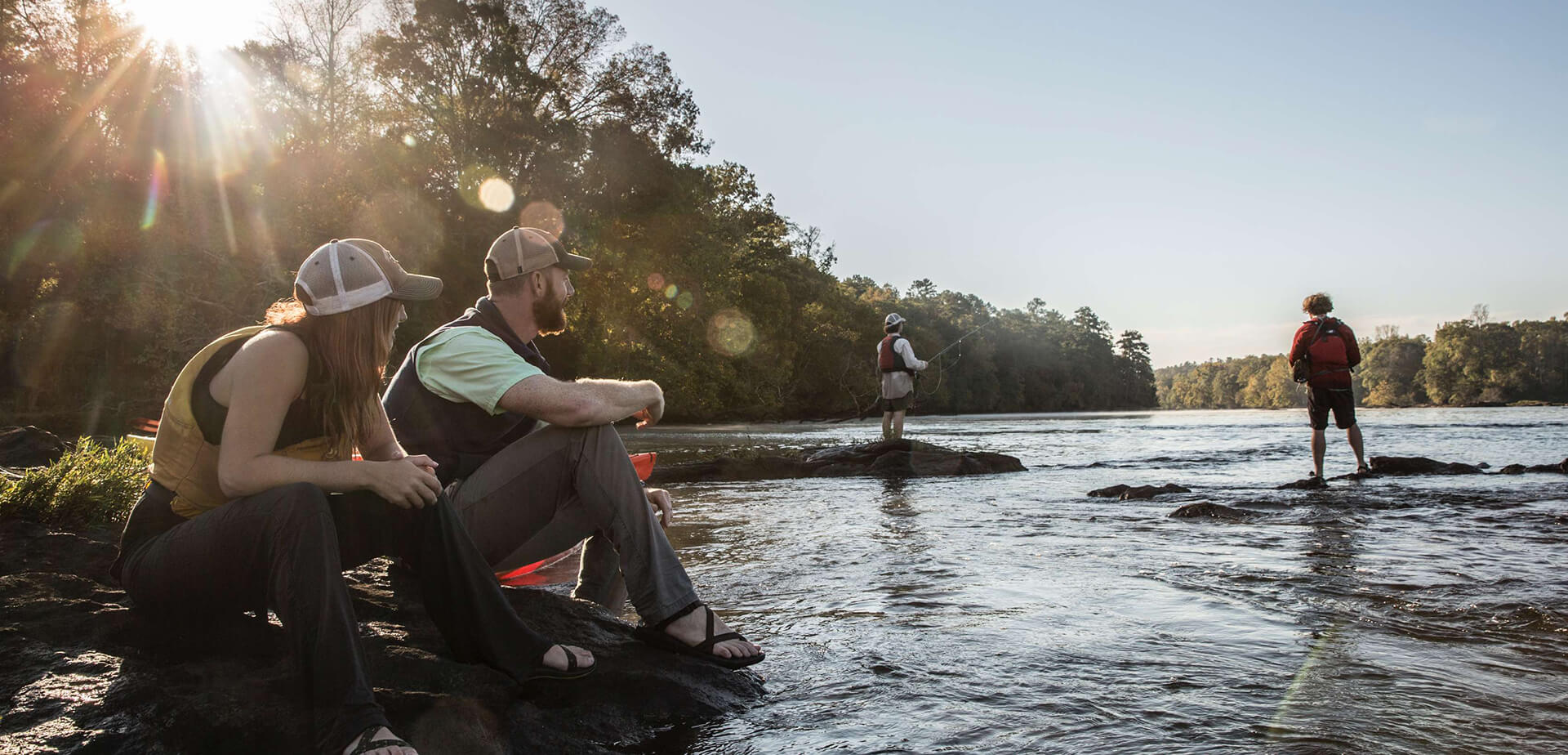
Yes! People of all ages and abilities will be invited to move along the RiverLands freely and comfortably. We are designing this project so that access from the land and water is designed for all ages and mobility levels, inviting the widest possible range of users.
The Chattahoochee RiverLands is a network of trails and water access points that connects all residents of the Metro Atlanta Region. These connections will be strategically accessible by pedestrians, bicyclists, drivers, and public transit users. The RiverLands will be connected to the region’s existing and growing public transit system and trail network.
People of all ages and abilities will be invited to move along the RiverLands Greenway freely and comfortably. Many of the roadways that cross the Chattahoochee River are unsafe for pedestrians, while roads that parallel the River have high rates of bicycle and pedestrian crashes. By incorporating off street trails, safe bicycles and pedestrians crossings into the Greenway design, the RiverLands will provide safe and comfortable passages that encourage active recreation in the region.
A primary function of the Chattahoochee RiverLands is to provide safe and protected routes for cyclists, pedestrians, and paddlers with regional connections to larger non-motorized transportation networks. Emergency response is the responsibility of local municipalities and the Greenway should be designed to accommodate emergency vehicle access. By working with River managers to publicize or broadcast River conditions, the RiverLands will promote safe and responsible activities on the River.
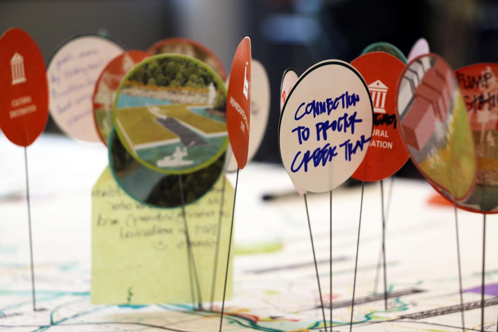
The Chattahoochee Working Group organized more than two years of community meetings, design charrettes, and public event to ensure the plan for the RiverLands reflected the community’s vision.
Within the RiverLands, shoreline riparian forests are regularly flooded and the trail is an opportunity to restore the floodplain to retain and store water within the riparian landscape. The trail, raised boardwalks, bridges, railings, benches and other proposed structures and objects in the floodplain will be flooded from time to time. This is typical in riverside trails. 48% of the Preferred Alignment falls within the Chattahoochee River 100-year floodplain. Local jurisdictions have adopted local floodplain management ordinances to regulate uses within or development within flood hazard areas to prevent flood damage. All measures should be taken during design and engineering to construct facilities that can withstand periodic flooding.
The River has a reputation for less-than-healthy water quality. Although the water quality of the River has improved it still has its bad days. Visit the BacteriAlert website to find out how safe is it to swim, wade, and boat in the Chattahoochee River. In addition, water conditions are influenced on a daily basis by water releases from Buford and Morgan Falls dams. Check the information about flow rates online before putting in.
Thank you! Visit our take action page to learn more.
The RiverLands is a generational project. While it will take decades to be fully completed, short individual segments and projects will be designed and built piece by piece over the course of time. Visit Explore Riverlands to learn more.
Trust for Public Land does not manage park reservations or amenity bookings. Parks along the RiverLands are owned and operated by various city, county, state, and federal agencies. Please contact the appropriate governing body for reservations or permit information.