
Other Revealing the RiverLands:


The Vision
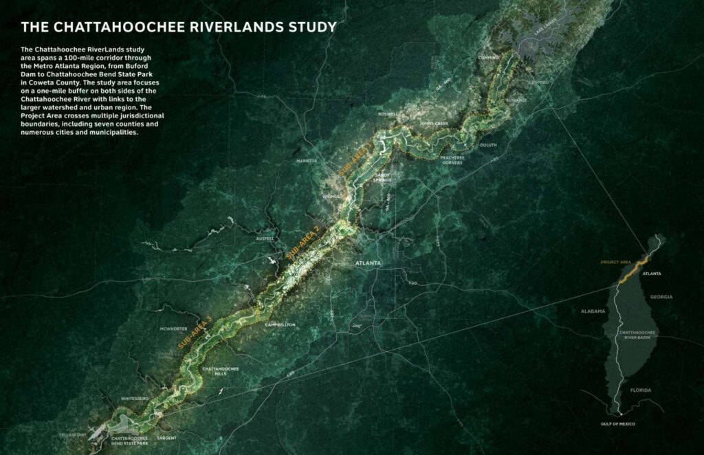
The Chattahoochee RiverLands study area spans a 100-mile corridor through the Metro Atlanta Region, from Buford Dam to Chattahoochee Bend State Park in Coweta County. The study area focuses on a one-mile buffer on both sides of the Chattahoochee River with links to the larger watershed and urban region. The Project Area crosses multiple jurisdictional boundaries, including seven counties and numerous cities and municipalities.
More than a trail, the RiverLands is a linear network of Greenways and Blueways that will bring people to the water’s edge, promote stewardship and conservation of the river, and reveal the subtle magic of the Chattahoochee to all.
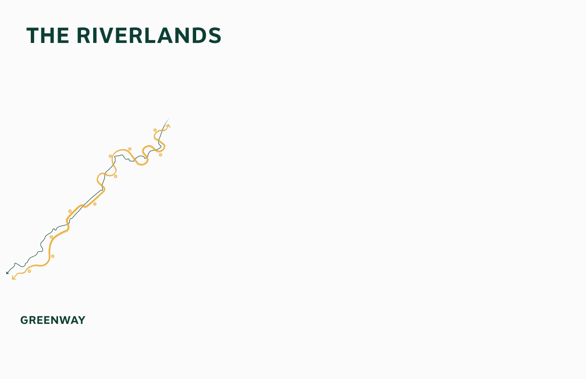
THE GREENWAY maximizes connectivity between River parks, River communities, River destinations, and the waterway itself by creating a multi-use, multi-modal trail that follows the River. It provides an immediate connection to the Chattahoochee, guiding people along its course and, at moments, invite people to its banks and shoals. The Greenway is carefully designed to balance needs of access and conservation, as its path will intersect riparian forests, wetlands, parks, and neighborhoods. The Greenway is the regional spine of the Chattahoochee RiverLands and all other RiverLands trails link back to this system.
THE BLUEWAY unlocks the resources of the waterway and invites people into the Chattahoochee. Serving motorized and non-motorized boating and floating, the Blueway reveals new methods of regional water-based movement. Stopping points along the water trail include campsites and picnic areas directly accessible from the water, enabling overnight and seasonal uses of the RiverLands. The Greenway and Blueway intersect along the River, offering direct water access and boat launches accessible to all users. These intersections are important nodes in the system and are distributed to serve the regional population and create opportunities for half day, full day, and overnight trips.
TRIBUTARY TRAILS link the wider community to the RiverLands. Tracing tributaries from regional population centers to the Greenway and Blueway, Tributary Trails connect neighborhoods and cities with the resources of the River. Tributary corridors are ideal opportunities for Tributary Trails, and many trails are already being planned by municipalities as local initiatives. Tributary Trails do not need to be aligned along water bodies: they can simply connect population centers to the Greenway and Blueway. Tributary Trails will be developed over time and are excellent opportunities for creative implementation partnerships.
The Project Goals
Four goal statements structure the approach to the Chattahoochee RiverLands and define a framework for design that equally prioritizes access, equity, ecology, and identity.
A Safe, Connective Corridor
The Chattahoochee RiverLands will connect communities along the river and the metro region. Connected trails, new parks, and an active public realm will provide opportunities for better health, physical activity, transportation, private reflection, and community cohesion. Thoughtful improvements in existing spaces and new connections will transform park and trail access for all.

A Common Ground For All
The Chattahoochee RiverLands will be accessible to people of all backgrounds, abilities, and ages. The resources of the River must be inviting to the widest possible range of people, creating a common ground for recreation and transportation that equitably serves the diverse and expanding communities of the Metro Atlanta region.
An Ecological Refuge For The Region
The Chattahoochee RiverLands will improve the ecological health of the river basin. Ecological restoration, park acquisition, land conservation, development standards, and other tools will provide strategic and holistic approaches for protecting sensitive species and ecosystems, reducing habitat fragmentation, improving water quality, and promoting the long-term revival of biodiversity.
A Living Legacy For Future Generations
The Chattahoochee RiverLands is a generational project that establishes a new, positive identity for the Chattahoochee River. Unfolding and evolving over many decades, the RiverLands will interpret the rich social and ecological history of the Chattahoochee while introducing an adaptive template that will guide regional planning decisions around growth, conservation, and stewardship.