
Other Revealing the RiverLands:


A Safe, Connective Corridor
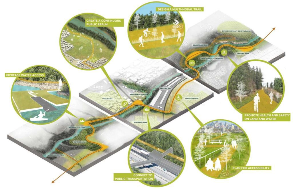
The Chattahoochee RiverLands will use different types of trails to connect communities along the river and across the metro region. The Greenway will be a multi-use path that serves active transportation and recreation by creating a safe, accessible, and connected route along the River. The Water Trail will link river communities and encourage boating, floating, swimming, and responsible use of the Chattahoochee’s waters. Tributary trails will provide safe routes of passage between the River and its surrounding communities, towns, and region. Public transportation will strategically connect to the RiverLands, enabling access and use of the Greenway as a resource for all residents of Metro Atlanta.

“The Chattahoochee River corridor is very special to everybody but the important thing is that we make it accessible to as many people as possible and one big problem we have is public transportation to the river.”
Jerry Hightower, National Park Service
DESIGN A MULTI-MODAL TRAIL

The RiverLands Greenway will support a variety of users, including but not limited to cyclists, pedestrians, kayakers, and horseback-riders. To accommodate the various speeds, and equipment requirements associated with these activities, the trail may vary in width, materiality, and number of branches, but will be linked with a common identity and visual language that creates a cohesive public realm.
CREATE A CONTINUOUS PUBLIC REALM

The RiverLands will connect communities to one another and to the River along a continuous public realm that traces the Chattahoochee. Diverse in nature, the Greenway will link communities of different backgrounds, income levels, and characters, creating a unique experience that stiches together iconic rural, urban, and suburban destinations.
CONNECT TO PUBLIC TRANSPORTATION
Today’s River is not well served by public transit. The RiverLands aims to provide direct and comfortable connections to public transportation, enabling residents of Metro Atlanta population to reach the River without a personal vehicle. The location of Greenway access points can be aligned to existing transit stops and new stops can be suggested to align with the main trail access points.
INCREASE WATER ACCESS

More points of water access are needed along the river, particularly in the southern reaches of the study area. The RiverLands imagines a linear water trail that has boat launches, resting spots, and camp sites accessible from the water, enabling a range of water-based river trips that range from hours to days.
PLAN FOR ACCESSIBILITY

People of all ages and abilities will be invited to move along the RiverLands Greenway freely and comfortably. Access from the land and water must be designed for all ages and mobility levels, inviting the widest possible range of users.
PROMOTE HEALTH AND SAFETY ON LAND AND ON WATER
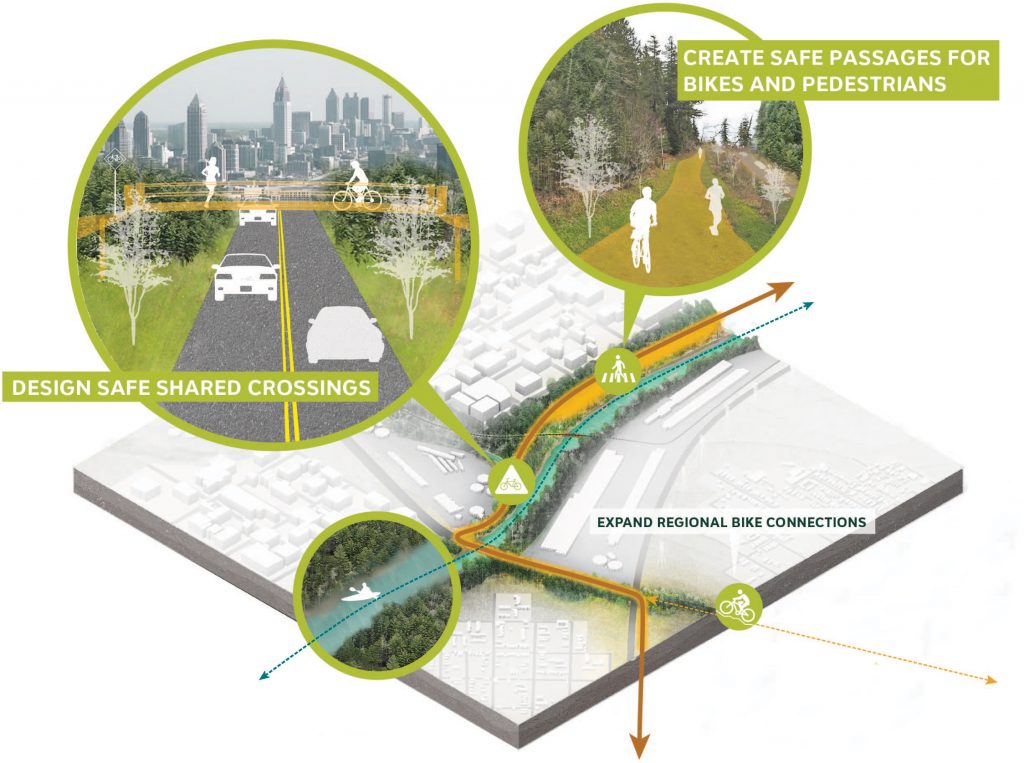
Many of the roadways that cross the Chattahoochee River are unsafe for pedestrians, while roads that parallel the river have high rates of bicycle and pedestrian crashes. A primary function of the Chattahoochee RiverLands is to provide safe and protected routes for cyclists and pedestrians with regional connections to larger non-motorized transportation networks. By incorporating off-street trails and bicycle/pedestrian-specific crossings into the Greenway design, the RiverLands will provide safe and comfortable passages that encourage active recreation in the region. By working with river managers to publicize or broadcast river dangers the RiverLands will promote safe and responsible activities on the river.