Chattahoochee River National Recreation Area (CRNRA) Palisades West Unit Trail
Location: 33.8916311, -84.446956
Trail Length: 4.1 miles
Difficulty: Relatively moderate
Trail details
Amenities
Paid Parking, Picnic Area
Trail type
Loop, Soft-surface
Activities
Fishing, Hiking, Walking
Attractions
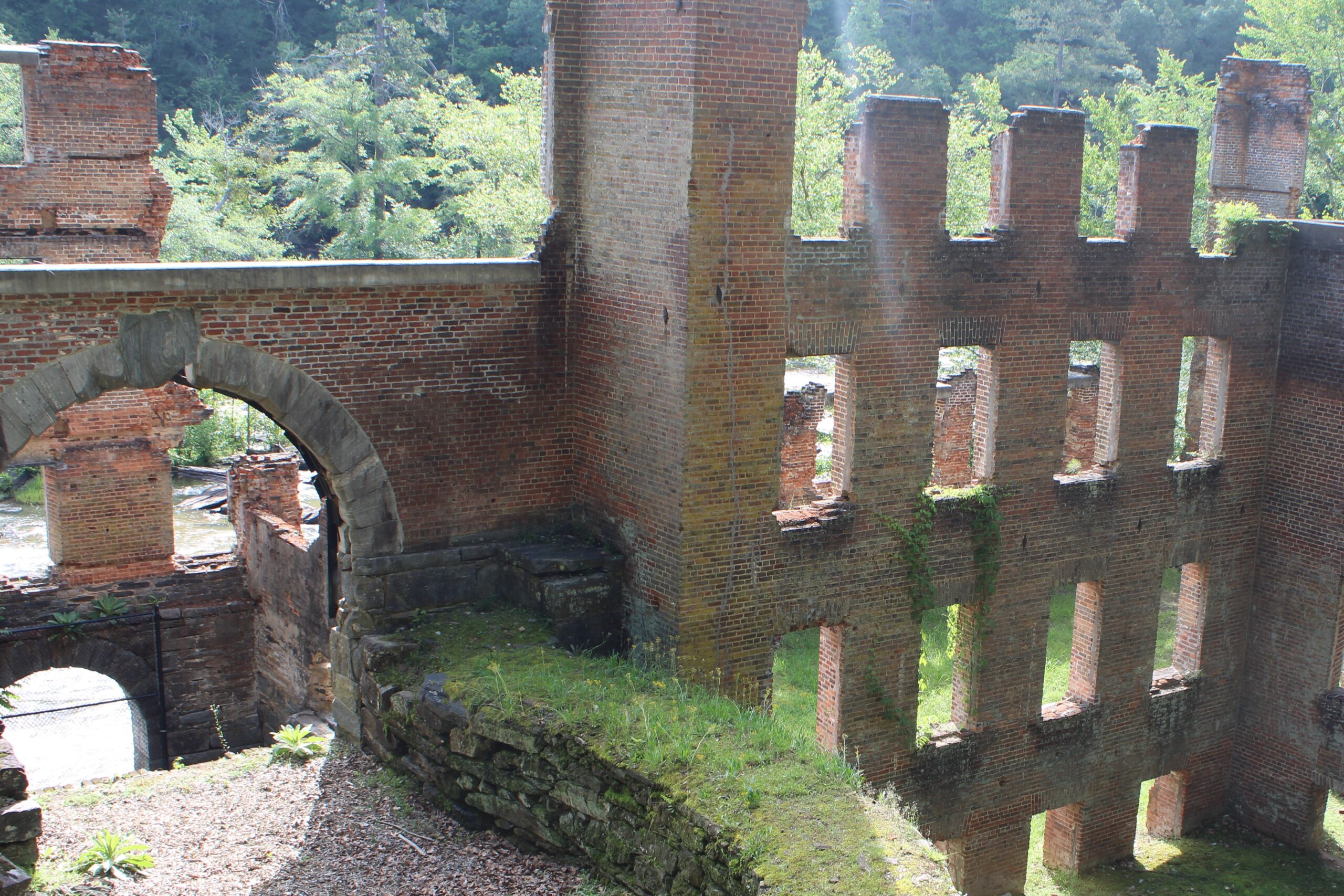
Boat Ramp, Canoe Launch, Historic Ruins
Hours of Operation
Sunrise to sunset
Share this Trail:
Trail details
Amenities
Paid Parking, Picnic Area
Trail type
Loop, Soft-surface
Activities
Fishing, Hiking, Walking
Attractions
Boat Ramp, Canoe Launch, Historic Ruins
Hours of Operation
Sunrise to sunset
Share this Trail:
Trail
overview
The Chattahoochee River splits the Palisades unit into an east and west side. The west side in the southernmost part of the park near the junction of I-75 and 1-285 northwest of Atlanta (close to Vinings) features a boat ramp and canoe launch, the last put-in or take-out within the Recreation Area. Access the Bob Callan Trail and the Rottenwood Creek Trails, both paved, through the west side of this park.
Along
the trail
Share your sights and stories as you experience how the RiverLands changes and grows over time. Just like you. Visit us on Instagram at @chattahoocheeriverlands to share photos and memories made along the trail.
Trail
history
The Chattahoochee River and its surrounding areas and network of trails are rich in history and culture, ecology and habitat, and community. Do you have historical information on this trail? Or a personal story? Share with us at riverlands@tpl.org