Accessing the River
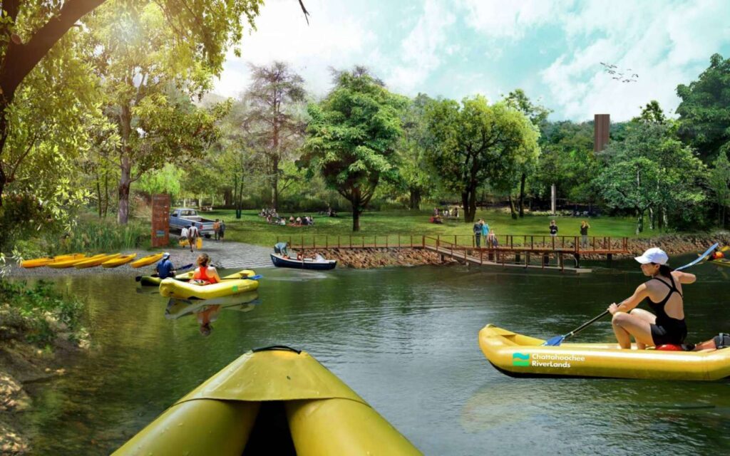
The Blueway unlocks the resources of the waterway and invites people into the Chattahoochee
More than a trail, the RiverLands is a linear network of Greenways and Blueways that will bring people to the water’s edge, and reveal the subtle magic of the Chattahoochee to all.The 104-mile Blueway unlocks the resources of the waterway and invites people into the Chattahoochee. With 42 water access points (one every 2 miles on average), the Blueway serves both motorized and non-motorized boating and floating, and reveals new methods of regional water-based movement.
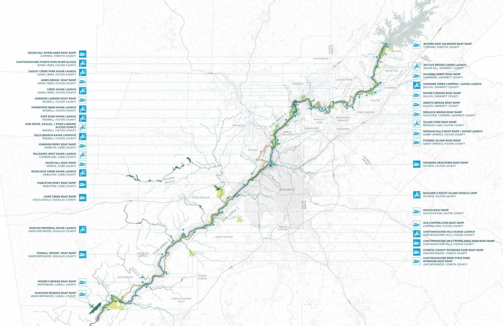
Stopping points along the water trail include campsites and picnic areas directly accessible from the water, enabling overnight and seasonal uses of the RiverLands. More than 40 parks are being directly connected by both the Greenway and the Blueway
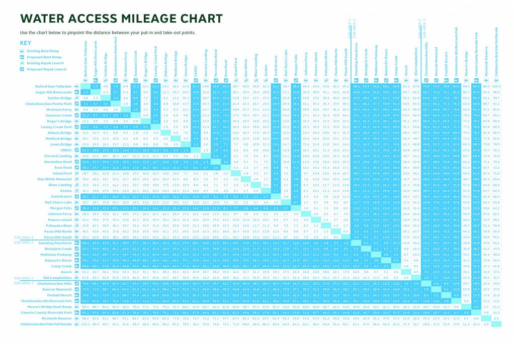
The Greenway and Blueway intersect along the River, offering direct water access and boat launches accessible to all users. These intersections are important nodes in the system and are distributed to serve the regional population and create opportunities for half day, full day, and overnight trips.